|
|
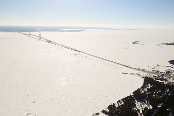
The Great Lakes Frozen, Canada–United States Border, North America
|
The Great Lakes are estimated to have been formed at the end of the last glacial period (about 10,000 years ago), when the Laurentide ice sheet receded. The retreat of the ice sheet left behind a large amount of meltwater (Lake Algonquin and Lake Iroquois) that filled up the basins that the glaciers had carved, thus creating the Great Lakes as we know them today. Because of the uneven nature of glacier erosion, some higher hills became Great Lakes islands. The Niagara Escarpment follows the contour of the Great Lakes between New York and Wisconsin.
Land below the glaciers "rebounded" as it was uncovered. Because the glaciers covered some areas longer than others, this glacial rebound occurred at different rates.
|
|