|
|
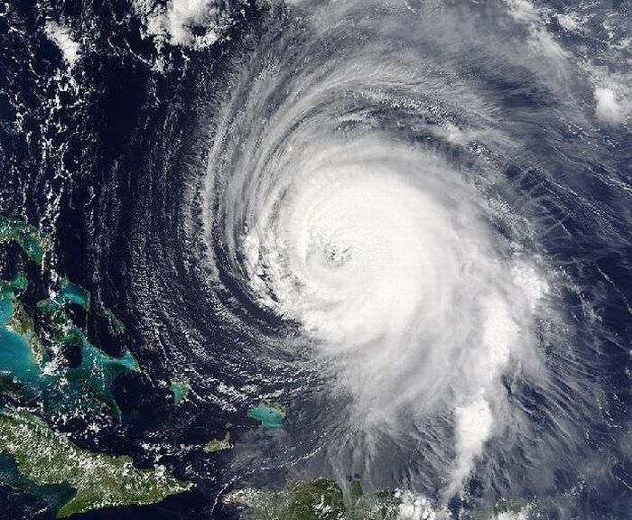
Hurricane Irene 2011 From Space
|
• North Carolina
In North Carolina, tropical-storm-force winds began to affect the Outer Banks hours before landfall, producing waves of 6–9 ft (1.8–2.7 m). In addition to the gales, Irene spawned several tornadoes early on August 27 while approaching the coast. No regular weather station or buoy, however, measured sustained hurricane-force winds from the storm, with the highest winds officially recorded at 67 mph (107 km/h) by a buoy near Cape Lookout. Precipitation totals from Irene in the region were particularly high, ranging between 10–14 inches (250–360 mm); Bunyan recorded a peak amount of approximately 14 inches (360 mm).
The large hurricane left extensive damage in its wake, with multiple leveled homes and overturned vehicles reported. Following the touch down of a potent tornado, at least four homes were demolished in Columbia, while up to three others sustained significant damage. Preliminary assessment indicated multiple flooded areas and uprooted trees along coastlines; in Nash County, a snatched tree limb struck and killed one person. Prior to the storm, a resident in Onslow County suffered a fatal heart attack while installing plywood to their home. Two people in Pitt and Sampson Counties were additionally killed by falling trees, as were two others in Goldsboro and Pitt County in traffic accidents. A man also drowned in the flooded Cape Fear River.
|
|