|
|
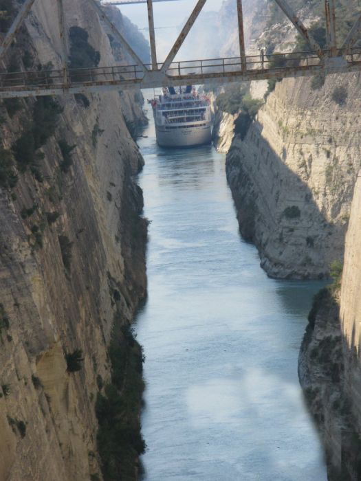
The Corinth Canal, Aegean Sea, Greece
|
Three years later, as German forces retreated from Greece, the canal was put out of action by German "scorched earth" operations. German forces used explosives to set off landslips to block the canal, destroyed the bridges and dumped locomotives, bridge wreckage and other destroyed infrastructure into the canal to hinder repair work. The United States Army Corps of Engineers began work to clear the canal in November 1947 and managed to reopen it for shallow-draft traffic by 7 July 1948, and for all traffic by that September.
Layout
The canal consists of a single channel 8 metres (26 ft) deep, excavated at sea level (thus requiring no locks), measuring 6,346 metres (20,820 ft) long by 24.6 metres (81 ft) wide at the top and 21.3 metres (70 ft) wide at the bottom. The rock walls, which rise 90 metres (300 ft) above sea level, are at a near-vertical 80° angle. The canal is crossed by a railway line, a road and a motorway at a height of about 45 metres (148 ft). In 1988 submersible bridges were installed at sea level at each end of the canal, by the eastern harbour of Isthmia and the western harbour of Poseidonia.
|
|