|
|
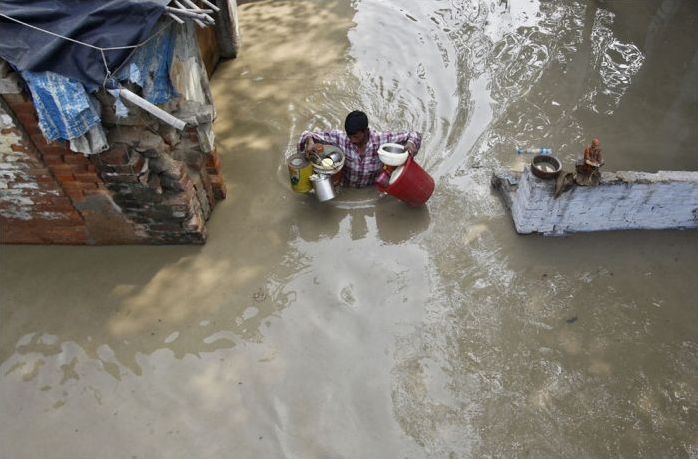
2013 Floods, Uttarakhand, Himachal Pradesh, North India
|
"The natural flow of water in Kedarnath was blocked by huge construction in recent years," said an Indian Space Research Organization (ISRO) official. ISRO monitors hydrological flow of major river basins in India. The absence of environmental regulations in various construction activities like dams, buildings etc. have caused this huge devastation. "There is no local planning and local authorities are not in control. The houses built on river banks are falling like a pack of cards. The floods are completely man-made, avoidable and criminal," said Sunita Narian, director general of Delhi based advocacy group Centre for Science and Environment (CSE). "These projects have been allowed without cumulative environment impact assessment on the region. With these projects come hotels, residential and commercial buildings, and roads. This piecemeal approach has contributed to the devastation," said Himashu Thakkar of South Asian Network on Dams, Rivers and People. A CSE analysis showed that vehicle population in the state almost tripled between 2005-06 and 2012-13. Cars, jeeps and taxis, the most preferred means of transport for tourists landing in the state, increased the most. "Most of these places have much more tourist inflow than the area's carrying capacity," said Bharat Jhunjhunwala, an environmental activist and a resident of Rudraprayag. ISRO satellite images show how Sangla valley, a key tourist attraction, had changed in the last few years. "What used to be an open green area (in Sangla) till a few years ago is now a concrete jungle," the ISRO official said. To top it, the 1,000 MW Karchham hydel project has been commissioned by making the Sutlej disappear for over 100 meters. Vinod Tare, senior faculty at IIT Kanpur and an expert on the Himalayan ecosystem, says when trees are removed, rocks blasted and unscientific anthropogenic pressure is exerted, nature plays havoc.
India accounts for one fifth of the deaths caused due to flooding across the world. Twenty-four out of the 35 States and Union Territories are vulnerable to disasters and over 5 percent of our landmass is vulnerable to floods. Annually, an average of about 18.6 million hectares of land area and 3.7 million hectares crop area are affected by flooding. The report of the 12th Five-Year Plan working group on ‘Flood Management and Region Specific Issues’, shows Uttarakhand’s flood vulnerabilities. Until March 2011, it included the coverage of 2000 hectares, compared to 18000 hectares in Himachal Pradesh. The state has created 9 km of embankment, a fraction of the 159.16 km completed in Himachal Pradesh; it has no drainage channels, whereas Himachal has constructed 11 km While 82 Himachal villages were protected through the raising of the ground level, none of the villages in Uttarakhand received such protection.
In 1976, the Government of India set up the National Flood Commission (Rashtriya Barh Ayog) “to evolve a coordinated, integrated and scientific approach to the flood control problems in the country and to draw out a national plan fixing priorities for implementation in the future.” Though the RBA report was submitted in 1980 and accepted by Government, not much progress seems to have been made in the implementation of its recommendations.
In 1997, the Building Materials and Technology Promotion Council created a ‘Vulnerability Atlas’ that mapped the extents of the disaster prone areas of the country. In light of fresh census data after 2001, it called for greater public awareness and the need for legislation that affected town planning, ‘techno-legal regimes’ for land use zoning in vulnerable areas, protection of critical buildings used by the public and, most significantly, the empowerment of local bodies to exercise control.
|
|