|
|
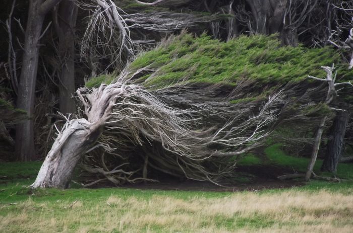
Windswept Trees, Slope Point, South Island, New Zealand
|
Slope Point lies just south of the small settlements of Waikawa and Haldane, near the southwestern edge of the Catlins and Toetoes Bay and 70 km (40 mi) east of Invercargill.
The land around Slope Point is used for sheep farming with no houses anywhere nearby. Eroded cliffs drop down to the sea below. An AA signpost there shows the distance to the Equator and the South Pole, and a small solar-powered lighthouse stands on farmland.
There is no road to Slope Point; it must be reached by a 20-minute walk following dilapidated yellow markers. There is no public access during the lambing season (September – November).
The region is consistently lashed with fierce and cold southwesterly winds that blow up from Antarctica. The wind there is so intense and relentless, that the trees are twisted, warped and forever bent along the direction the wind blows. There are a few derelict shacks built under the protection of the windswept trees, but even those are abandoned.
|
|