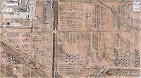
Interesting Places On Google Earth
Thursday, 13th February 2014, 12:30:07
Album: World & Travel, New uploads: 5, Hits: 373, Size: 0MiB
Google Earth is a virtual globe, map and geographical information program that was originally called EarthViewer 3D, and was created by Keyhole, Inc, a company acquired by Google in 2004. It maps the Earth by the superimposition of images obtained from satellite imagery, aerial photography and GIS 3D globe...
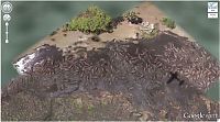
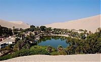
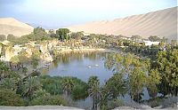
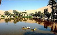
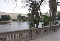
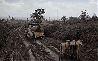
Huacachina, Oasis Of America, Ica Region, Peru
Monday, 10th February 2014, 16:01:26
Album: World & Travel, New uploads: 29, Hits: 4933, Size: 2MiB
Huacachina is a village in the Ica Region, in southwestern Peru. It has a population of 115. The village is built around a small natural lake in the desert. Called the "oasis of America," it serves as a resort for local families from the nearby city of Ica, and increasingly as an attraction for tourists drawn by the sports of sandboarding and taking dune buggy rides on sand dunes that stretch several hundred feet high...
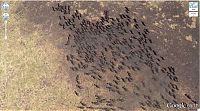
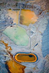
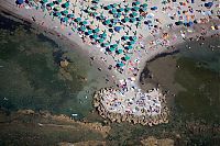
Bird's-eye View Aerial Landscape Photography
Thursday, 30th January 2014, 10:28:17
Album: World & Travel, New uploads: 22, Hits: 5676, Size: 2MiB
A bird's-eye view is an elevated view of an object from above, with a perspective as though the observer were a bird, often used in the making of blueprints, floor plans and maps.
It can be an aerial photograph, but also a drawing. Before manned flight was common, the term "bird's eye" was used to distinguish views drawn from direct observation at high locations (for example a mountain or tower), from those constructed from an imagined (bird's) perspectives...


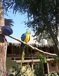
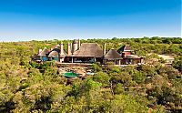
Leobo Private Reserve, Limpopo Province, South Africa
Friday, 17th January 2014, 13:19:00
Album: World & Travel, New uploads: 22, Hits: 5677, Size: 1MiB
Leobo Private Reserve is situated in the Waterberg region of South Africa, a 12,000-acre malaria-free reserve overlooking the Palala Valley. Playful is what Leobo is; a vast nature-reserve, teeming with plains game and birdlife...


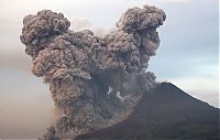
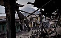
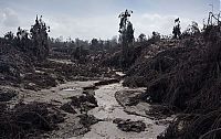
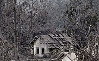
Mount Sinabung, January 2014 Eruption, Karo Regency, North Sumatra, Indonesia
Thursday, 16th January 2014, 22:05:02
Album: World & Travel, New uploads: 22, Hits: 3398, Size: 1MiB
Mount Sinabung (Indonesian: Gunung Sinabung) is a Pleistocene-to-Holocene stratovolcano of andesite and dacite in the Karo plateau of Karo Regency, North Sumatra, Indonesia, 25 miles from Lake Toba supervolcano. Many old lava flows are on its flanks and the last known eruption, before recent times, occurred in the year 1600...
| History | 1 | - | 7 | 8 | 9 | 10 |
|


|
||||||||||||||
